Appendix B: Map Task Summary
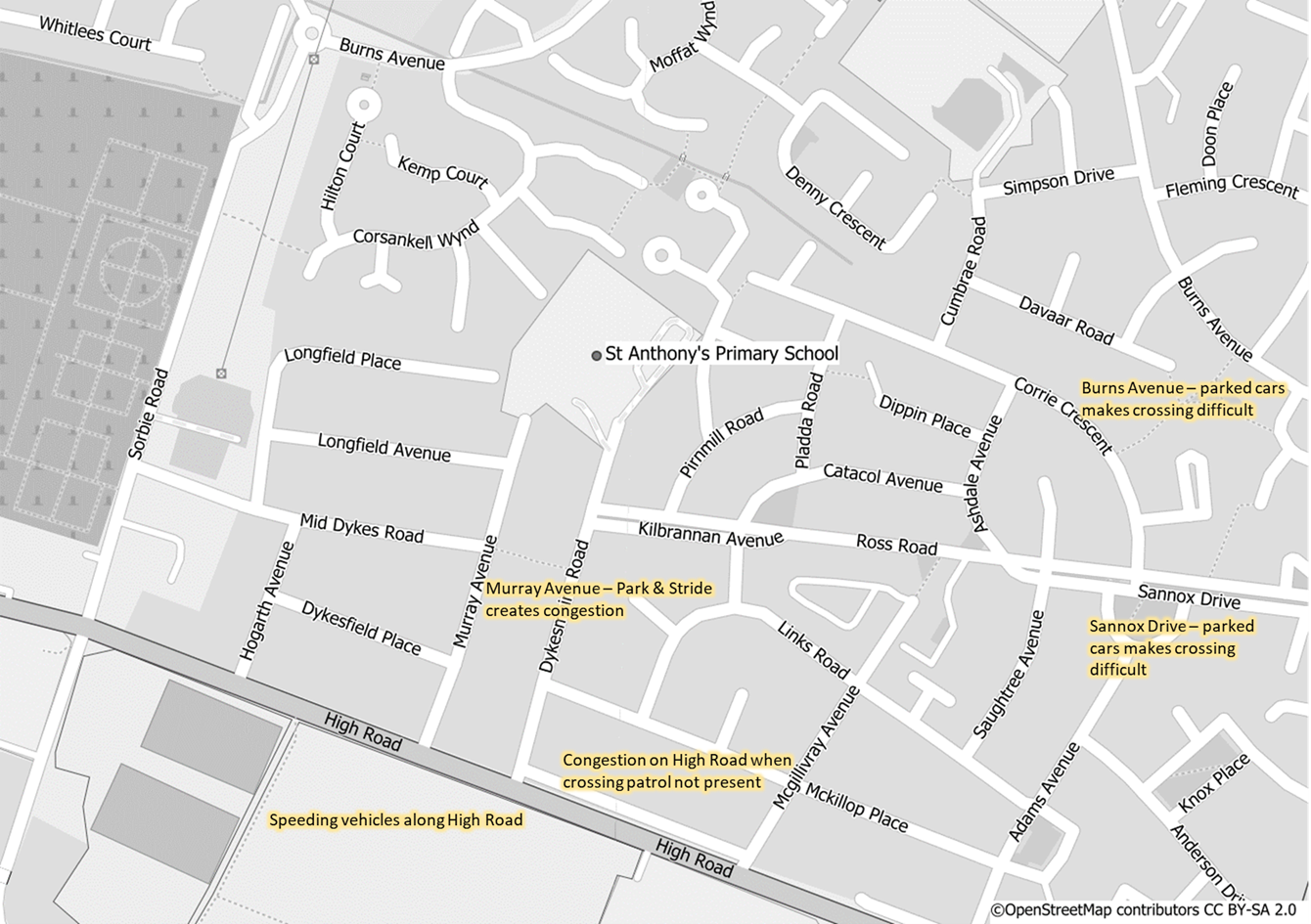
This is a map showing St Anthony's Primary School and the surrounding area. The map is annotated with problems identified by the pupil focus groups relating to safe active travel to school. Annotations include:
- Speeding vehicles on High Road
- Congestion on High Road when crossing patrol is not present
- Murray Avenue - park and stride creates congestion
- Sannox Drive - parked cars makes crossing difficult
- Burns Avenue - parked cars makes crossing difficult
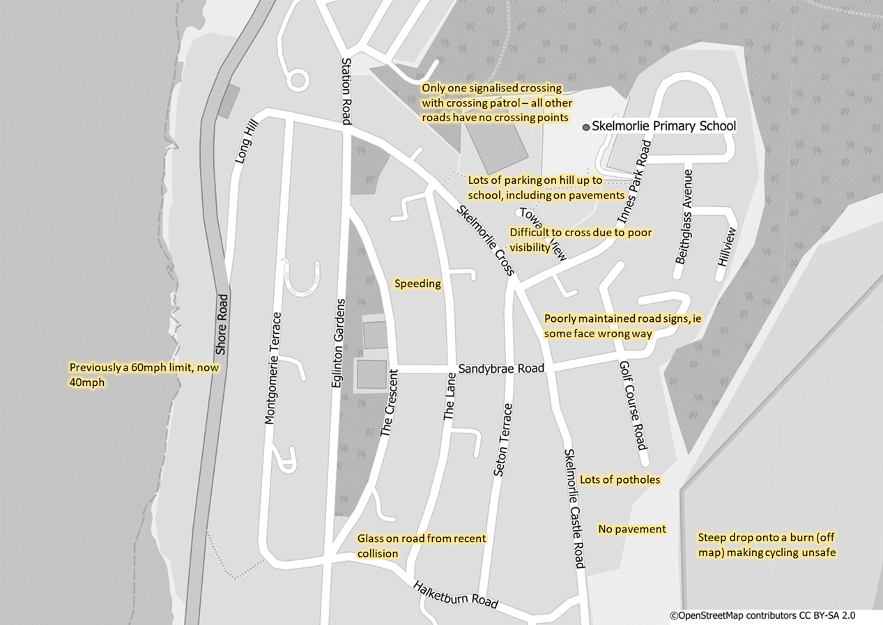
This is a map showing Skelmorlie Primary School and the surrounding area. The map is annotated with problems identified by the pupil focus groups relating to safe active travel to school. Annotations include:
- Skelmorlie Castle Road - no pavement and lots of potholes and a steep drop onto a burn making cycling unsafe
- Halketburn Road - glass on road from recent collision
- Shore Road - previously 60mph limit, now 40 mph
- Speeding
- Poorly maintained road signs i.e. some face the wrong way
- Difficulty crossing near the school due to poor visibility
- Lots of parking on the hill and pavements leading up to the school
- Only one signalised crossing with crossing patrol - all other roads have no crossing points
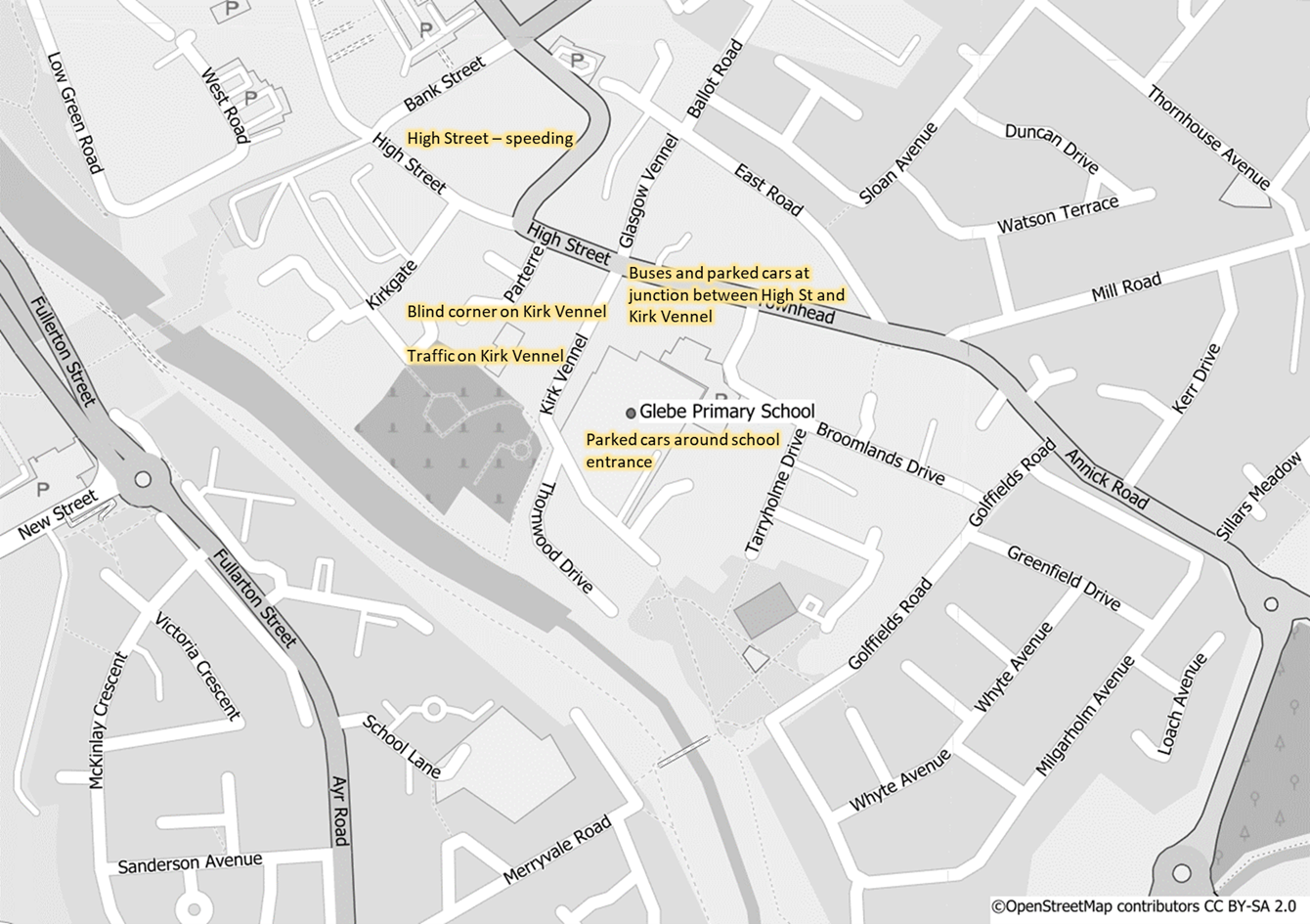
This is a map showing Glebe Primary School and the surrounding area. The map is annotated with problems identified by the pupil focus groups relating to safe active travel to school. Annotations include:
- Parked cars around the school entrance
- Kirk Vennel - High volumes of traffic and restricted view on the corner
- Buses and cars parked at the junction between Kirk Vennel and High Street
- Speeding along High Street
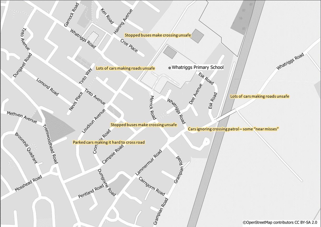
This is a map showing Whatriggs Primary School and the surrounding area. The map is annotated with problems identified by the pupil focus groups relating to safe active travel to school. Annotations include:
- High volume of traffic around the school making crossing unsafe
- Stopped buses making crossing unsafe
- Cars ignoring crossing patrol in Whatriggs Road, resulting in some "near misses"
- Stopped buses and parked cars making crossing around the school difficult.
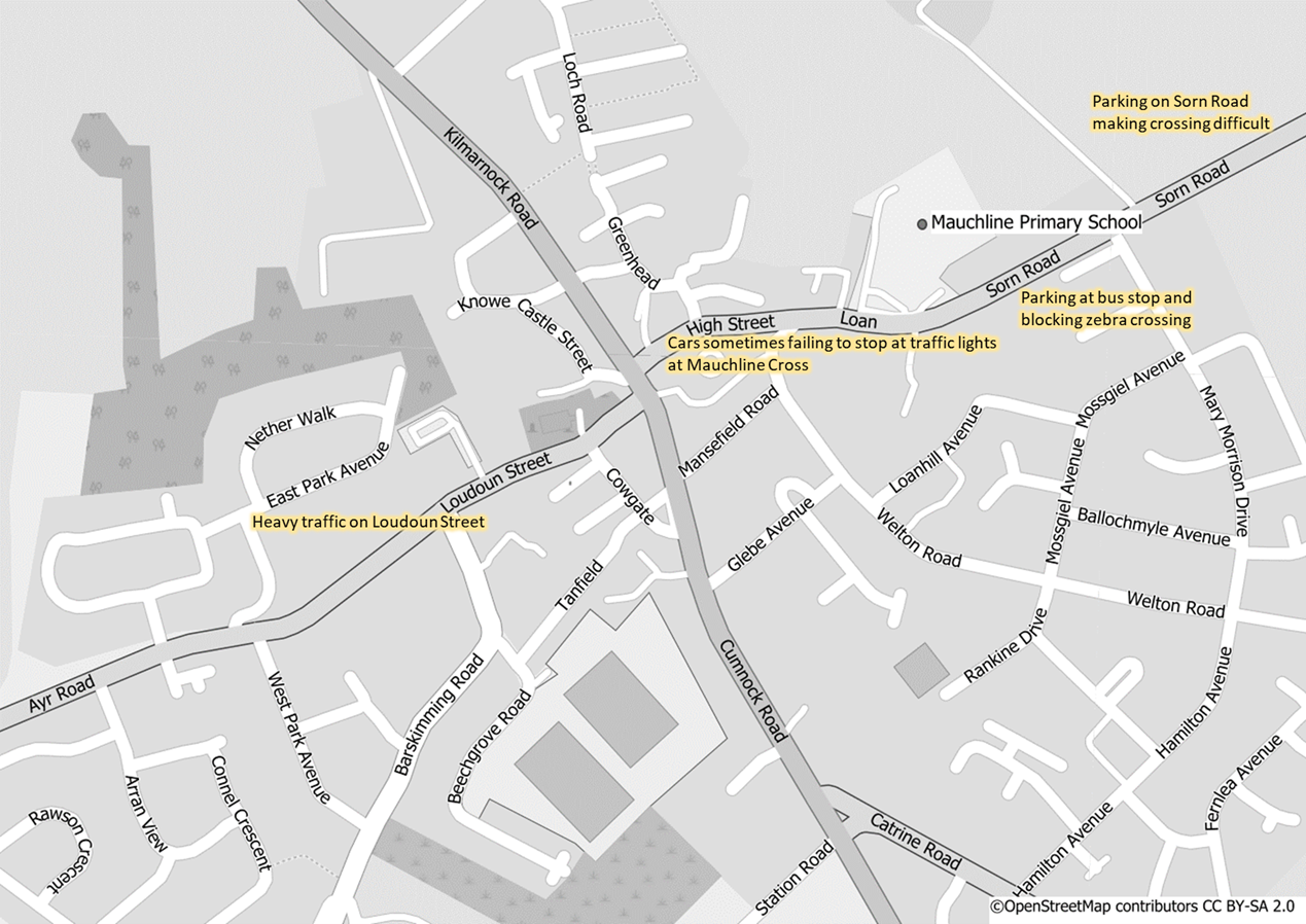
This is a map showing Mauchline Primary School and the surrounding area. The map is annotated with problems identified by the pupil focus groups relating to safe active travel to school. Annotations include:
- Parking on Sorn Road making crossing difficult
- Sorn Road - parking at bus stop and blocking zebra crossing
- Cars sometimes failing to stop at the traffic lights at Mauchline Cross
- Heavy traffic on Loudoun Street
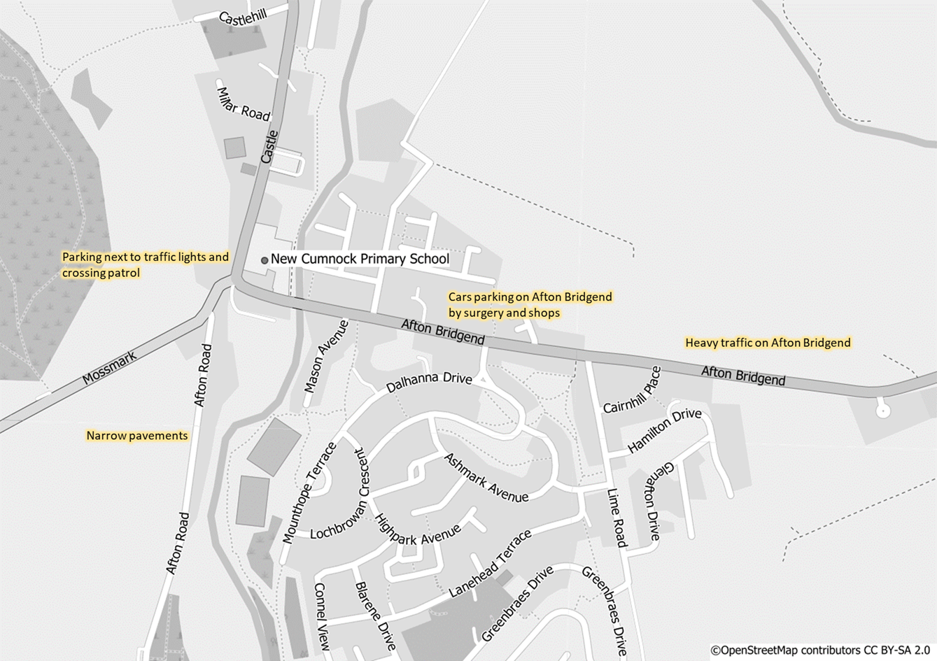
This is a map showing New Cumnock Primary School and the surrounding area. The map is annotated with problems identified by the pupil focus groups relating to safe active travel to school. Annotations include:
- Heavy Traffic on Afton Bridgend
- Cars Parked on Afton Bridgend by the surgery and shops
- Narrow pavements on Afton Road
- Parking next to traffic lights and crossing patrol
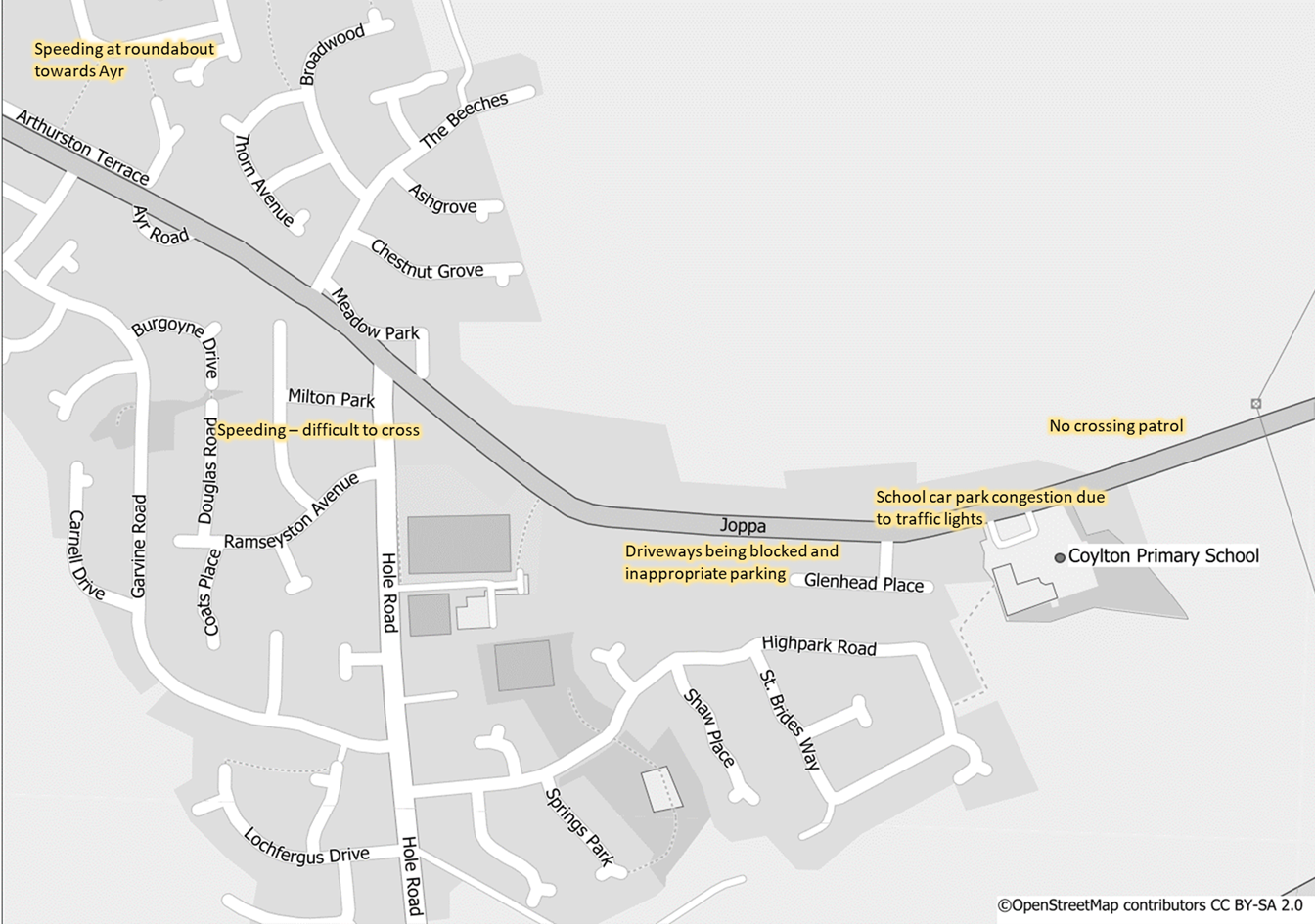
This is a map showing Coylton Primary School and the surrounding area. The map is annotated with problems identified by the pupil focus groups relating to safe active travel to school. Annotations include:
- Speeding on Hole Road making it difficult to cross
- Driveways being blocked and inappropriate parking on Joppa
- School car park congested due to traffic lights
- No crossing patrol
- Speeding at the roundabout towards Ayr
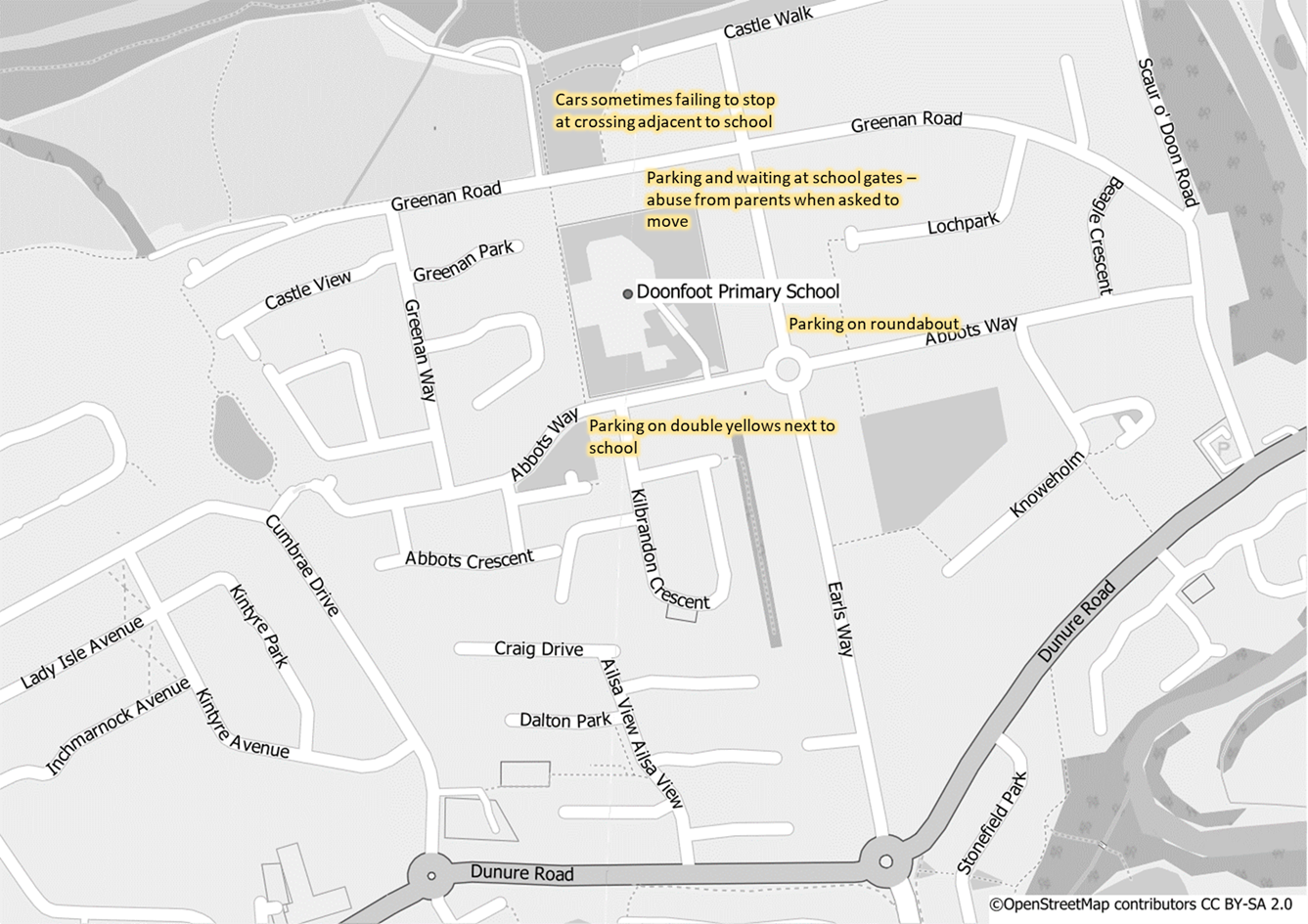
This is a map showing Doonfoot Primary School and the surrounding area. The map is annotated with problems identified by the pupil focus groups relating to safe active travel to school. Annotations include:
- Parking on double yellow lines next to the school
- Parking on roundabout next to the school
- Parking and waiting at school gates
- Cars failing to stop at crossing adjacent to the school
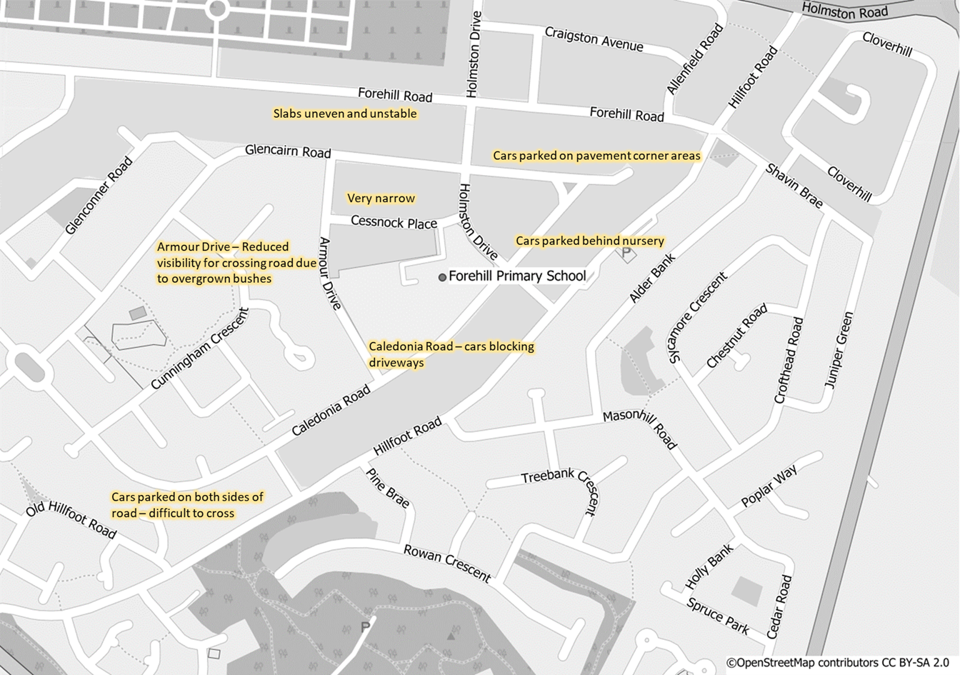
This is a map showing Forehill Primary School and the surrounding area. The map is annotated with problems identified by the pupil focus groups relating to safe active travel to school. Annotations include:
- Cars parked on both sides of the road making it difficult to cross, cars blocking driveways and parked behind the nursery
- Narrow roads around school
- Armour Drive - overgrown bushes restrict crossing visibility
- Pavement uneven and unstable